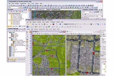
OpenFlows™ WaterGEMS® Water Distribution Modeling And Management

OpenFlows WaterGEMS is a hydraulic modeling application for water distribution systems with advanced interoperability, geospatial model building, optimization, and asset management capabilities.
Superior Interoperability
With OpenFlows WaterGEMS, you can work across CAD, GIS, and stand-alone platforms while accessing a single, shared project data source. The application gives you the choice of modeling from within three interoperable platforms:
- Windows for ease of use, accessibility, and performance.
- ArcGIS for GIS integration, thematic mapping, and publishing.
- AutoCAD for CAD layout and drafting.
Streamlined Model Building
You can leverage geospatial data, CAD drawings, databases, and spreadsheets to jumpstart the model building process. OpenFlows WaterGEMS provides synchronized database connections, geospatial links, and advanced model building modules that connect with virtually any digital data format. The included LoadBuilder and TRex modules can help you allocate water demands and node elevations based on geospatial data found in shapefiles, geodatabases, various types of DEMs, and even CAD drawings. These modules help you avoid mistakes caused by manual input. OpenFlows WaterGEMS also provides drawing and connectivity review tools to guarantee a hydraulically coherent model. Skelebrator® automatically removes network complexity while maintaining hydraulic equivalence to efficiently tackle a wider range of modeling applications.
View the full datasheet for more details.
