
Restoring A Unique Area In Northwest Indiana
By U.S. EPA

The Indiana Harbor Canal (IHC) is a created waterway on the southwest shore of Lake Michigan, in East Chicago, Lake County, Indiana. This IHC is located in one of the most industrialized areas in the country and is also home to some of the greatest diversity of native plant and animal communities in the Great Lakes Basin. The geology of this region of northwest Indiana includes glacial landforms of marshes and wetland prairie ecosystems. This is a result of the influence of Lake Michigan water levels and the highlands to the south.
Railroads and canals including IHC were constructed in the early 1900s to connect the Grand Calumet River to Lake Michigan. This coincided with the southern shoreline of Lake Michigan becoming the site of major industrial development. Several industries were established in the area to reap the benefits of access to the Great Lakes, multiple railroads, and Chicago, which during this time was the fastest growing city in Illinois.
Heavy use of railroads and canals in northwestern Indiana during World Wars I and II, to support the steel and oil refining industries, combined with the absence of strict environmental laws on waste management and controlling stormwater, contributed to industrial waste that polluted the Great Lakes and associated canals. As a result, the Grand Calumet River has been recognized as an Area of Concern (AOC) since the 1980s.
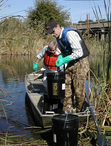
For more than 20 years, federal, state, and local agencies have been working together to restore the Grand Calumet River system. As part of this ongoing cooperative effort, EPA scientists are providing technical assistance to several projects associated with the Grand Calumet River.
Periodic removal of Polychlorinated Biphenyls (PCB) — contaminated sediment within the IHC, under the direction of the United States Army Corps of Engineers (USACE), is necessary for commercial navigation to be able to use both the harbor and canal. Sediment deposits can alter the flow of water and reduce water depth, which makes navigation more difficult.
Ed Barth, EPA engineer and recognized international expert on hazardous waste management practices, has been working with a team of geologists and engineers from EPA’s Region 5 and the Indiana Department of Environmental Management (IDEM) on management disposal options. One option includes disposal of the contaminated sediment into large, confined disposal facilities (CDFs). Barth was instrumental in the conception, field sampling, design, and construction of both the original and planned dike expansion of the Indiana Harbor.
“Safe management of the removed sediment is necessary in both the short-term and long-term to make sure the dredged sediments do not to pose a future threat to public health and the environment, especially if the sediment is contaminated with industrial chemicals,” explained Barth.
Barth worked closely with Region 5 technical experts and IDEM to make sure that the original 2010 CDF perimeter dike design plans were technically sound, and that precipitation and strong winds do not result in dike erosion.
“Working on a team that included traditional academic disciplines of engineering, soil science, and geology was absolutely critical to confirm that the design approach, assumptions, failure mechanism modeling, and correct safety factors were carefully considered by the USACE,” Barth said. “The CDF was originally designed to contain 1.8 million cubic yards of contaminated sediment. By comparison, a standard garbage truck contains only 28 cubic yards.”
Between 2019 and 2021, Barth worked with the same team to review the proposed dike expansion plan to safely elevate the dike height to contain an additional 3.0 million cubic yards of contaminated sediment during future dredging operations, for a total of 4.8 million cubic yards. The initial reviews of both the original design and planned expansion provided by the team resulted in several design clarifications by the USACE to ensure that the CDF has a very low risk for failure. The IHC CDF is just one of several on-going projects that EPA is involved with on the Grand Calumet River including the remediation of the river (dredging and sediment capping), and subsequent sediment and water quality monitoring.
Learn More: