
Surveys From Above Give Scientists A New Perspective On Water

A new way of exploring the Mighty Mississippi and surrounding aquifers will take flight in August not by boat; rather, the sky, to identify what resources lie beneath.
In February, 2018, the USGS began the first phase of airborne geophysical surveys in a series of high-resolution flights near Greenwood, Mississippi, to acquire large-scale airborne geophysical data in support of the Mississippi Alluvial Plain (MAP) Regional Water Availability Study. The contract was awarded to CGG, and the USGS is working in partnership with multiple state agencies to conduct the research. The geophysical instruments used in this study are able to map aquifer properties below ground, to depths of up to about 1,000 feet.
This airborne survey, which could last through 2022, will be used to map nearly 100,000 square kilometers, or 38,627 square miles, of the surficial Mississippi River Valley alluvial aquifer system, which includes portions of seven states—Illinois, Missouri, Kentucky, Tennessee, Arkansas, Mississippi and Louisiana. A multi-sensor platform featuring electromagnetic, magnetic and radiometric sensors will be deployed to map the underground aquifer system and deeper hydrogeologic setting.
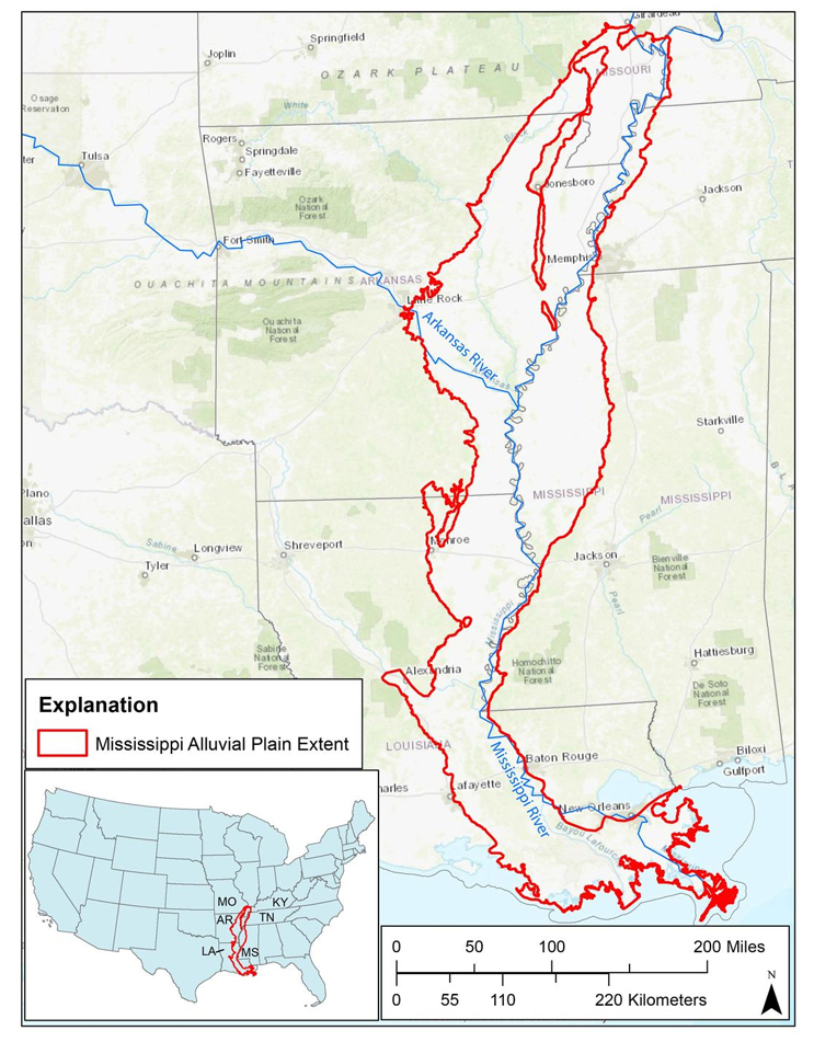
The Mississippi River Valley Alluvial Aquifer highlighted within the larger Mississippi Alluvial Plain. (Public domain.)
Each subsequent airborne geophysical survey, including the upcoming August effort also based out of Greenwood, Mississippi, will last approximately one-to-two months and cover the regional flight lines over the entire MAP project area. Additional data collection efforts will take place in following years as mapping needs and funding are identified.
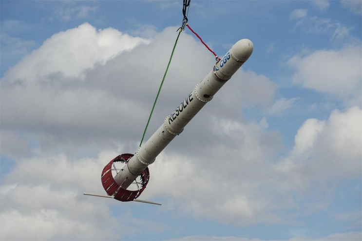
CGG RESOLVE helicopter system in Greenwood, Mississippi. The USGS is working with CGG and other partners to gather geophysical information related to the Mississippi Alluvial Plain. The helicopter will be deployed in several smaller focus areas of interest where a series of high-resolution survey grids will be acquired. (Credit: Burke Minsley, USGS. Public domain.)
“This represents the largest-to-date public-sector initiative to acquire airborne electromagnetic data for hydrologic applications in the United States,” said Don Cline, Associate Director for the USGS Water Resources Mission Area. “The data collected from these surveys will greatly improve our knowledge of water resources in the MAP study area.”
Interpretative products developed from this survey will include improved maps of the below-surface aquifer system that are needed to better inform water availability models. They will help support collaborative engineering projects with the U.S. Army Corps of Engineers and the United States Department of Agriculture’s Agricultural Research Service as well as address the needs of state and local water resource managers in the MAP region.
"The MAP airborne geophysical survey will allow us to develop a high-resolution three-dimensional representation of the groundwater resources for one the most important irrigated agricultural regions in the U.S.," said project lead and USGS scientist Wade H. Kress.
Regional data collection will be accomplished with the CGG Tempest fixed-wing system that will acquire data along a pre-planned grid of flight lines that spans the entire survey area . Flight paths will be separated by approximately 2 to 12 kilometers—1.2 to 7.5 miles—in the first year, and funding in subsequent years will be used to enhance the overall survey resolution by adding additional flight lines in between those previously flown. In addition, the CGG RESOLVE helicopter system will be deployed in several smaller focus areas of interest where a series of high-resolution survey grids will be acquired.
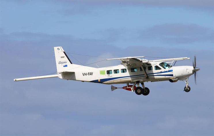
CGG Tempest Fixed-Wing Aircraft. The USGS is working with CGG and other partners to gather geophysical information related to the Mississippi Alluvial Plain. The helicopter will be deployed in several smaller focus areas of interest where a series of high-resolution survey grids will be acquired. (Credit: Amanda Heydorn, CGG. Public domain.)
“Airborne geophysical data fill a critical role in aquifer mapping studies, since such large-scale data cannot be acquired effectively on the ground,” said Dr. Burke Minsley, a Denver-based USGS research geophysicist who is helping to lead the airborne geophysical effort. “We are excited to add cutting-edge airborne geophysical technologies to advance groundwater modeling and decision-making efforts in this study.”
As with all USGS data, the information acquired from the airborne surveys will undergo rigorous analysis. The data will then be integrated with groundwater modeling efforts prior to becoming fully available to the public.

CGG RESOLVE helicopter system in Greenwood, Mississippi. The USGS is working with CGG and other partners to gather geophysical information related to the Mississippi Alluvial Plain. The helicopter will be deployed in several smaller focus areas of interest where a series of high-resolution survey grids will be acquired. (Credit: Burke Minsley, USGS. Public domain.)
For more information about the project and for future updates, visit the Mississippi Alluvial Plain (MAP) Regional Water Availability Study.
Source: USGS