Exploring WinCan-Based Mapping Workflows

Having complete, accessible mapping data is integral to job site coordination, and it’s often required in the broader analysis of sewer system health. Over the years, WinCan has expanded its mapping features intentionally, ensuring sewer teams are able to navigate their systems with accurate, up-to-date data and visualization. As technology evolves, it’s vital that these mapping capabilities are accessible in the cloud, compiling data from various sources to paint a more vivid picture of what work is getting done where, and the implications of inspection results.
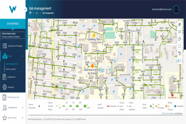
Among WinCan’s most popular cloud mapping capabilities is the integration between WinCan VX and Esri’s ArcGIS, which provides seamless data transfer. Recently, the WinCan Web platform also introduced a variety of convenient mapping features as part of its enterprise solution, giving sewer inspection teams more flexible analysis and project management capabilities.
Get unlimited access to:
Enter your credentials below to log in. Not yet a member of Water Online? Subscribe today.
