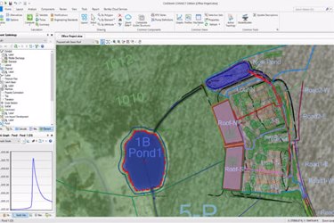
OpenFlows™ CivilStorm®

OpenFlows CivilStorm performs comprehensive analysis of all aspects of stormwater systems, including rainfall, runoff, inlet capture and bypass, gravity and pressure piping, ponds, outlet structures, open channels, culverts, and more. Engineers can analyze pressure and free-surface flow conditions for networks of channels and closed conduits, model complex pond outlets for a variety of tailwater conditions, and use weirs, orifices, culverts, risers, and inlet boxes in their design, all within a single product.
Model as Stand Alone or within Your Favorite CAD Platform
OpenFlows CivilStorm works as a stand-alone application, or can be run within OpenRoads, OpenRail, and OpenSite® Designer, or AutoCAD. Regardless of the platform used, CivilStorm maintains a single set of modeling files for true interoperability across platforms, as well as support for multiple background layers, conversion utilities from CAD, GIS, and databases, and unlimited undo and redo.
OpenFlows CivilStorm can run from within the OpenRoads/OpenRail/OpenSite platform – at no additional cost – providing a geospatial and engineering design environment with unrivaled visualization and publishing tools. AutoCAD users can choose to add support for running OpenFlows CivilStorm models from within AutoCAD to build and lay out models with engineering precision in an environment with which they are already comfortable.
Streamlined Model Building
Engineers can leverage geospatial data, CAD drawings, databases, and spreadsheets to jump-start the model-building process. OpenFlows CivilStorm provides synchronized database connections, geospatial links, and advanced model-building modules that connect with virtually any digital data format. In addition, modelers can import SWMM files as well as StormCAD® files. OpenFlows also provides drawing and connectivity review tools to guarantee a hydraulically coherent model.
